States Ranked by Land Area

States Ranked by Land Area
Ranking - Geography
Quick Answer
States Ranked by Land Area
-
1
Alaska (570,641 sq mi) is the largest state in the USA by land area, Texas (261,914 sq mi) is the second-largest and the biggest state in the contiguous United States, and Rhode Island (1,034 sq mi) is the smallest — more than 550 times smaller than Alaska.
-
2
All 10 of the largest states are west of the Mississippi River. All 10 of the smallest states are in the East, concentrated in New England and the Mid-Atlantic.
Map
U.S. States by Area Map

| Rank | State | sq mi |
|---|---|---|
| 1 | Alaska | 570,641 |
| 2 | Texas | 261,914 |
| 3 | California | 155,959 |
| 4 | Montana | 145,552 |
| 5 | New Mexico | 121,298 |
| 6 | Arizona | 113,594 |
| 7 | Nevada | 109,781 |
| 8 | Colorado | 103,642 |
| 9 | Wyoming | 97,093 |
| 10 | Oregon | 95,988 |
| 11 | Idaho | 82,643 |
| 12 | Utah | 82,170 |
| 13 | Kansas | 81,759 |
| 14 | Minnesota | 79,627 |
| 15 | Nebraska | 76,824 |
| 16 | South Dakota | 75,811 |
| 17 | North Dakota | 69,001 |
| 18 | Missouri | 68,742 |
| 19 | Oklahoma | 68,595 |
| 20 | Washington | 66,456 |
| 21 | Georgia | 57,513 |
| 22 | Michigan | 56,539 |
| 23 | Iowa | 55,857 |
| 24 | Illinois | 55,519 |
| 25 | Wisconsin | 54,158 |
| 26 | Florida | 53,625 |
| 27 | Arkansas | 52,035 |
| 28 | Alabama | 50,645 |
| 29 | North Carolina | 48,618 |
| 30 | New York | 47,126 |
| 31 | Mississippi | 46,923 |
| 32 | Pennsylvania | 44,743 |
| 33 | Louisiana | 43,204 |
| 34 | Tennessee | 41,235 |
| 35 | Ohio | 40,861 |
| 36 | Virginia | 39,490 |
| 37 | Kentucky | 39,486 |
| 38 | Indiana | 35,826 |
| 39 | Maine | 30,843 |
| 40 | South Carolina | 30,061 |
| 41 | West Virginia | 24,038 |
| 42 | Maryland | 9,707 |
| 43 | Vermont | 9,217 |
| 44 | New Hampshire | 8,953 |
| 45 | Massachusetts | 7,800 |
| 46 | New Jersey | 7,354 |
| 47 | Hawaii | 6,423 |
| 48 | Connecticut | 4,842 |
| 49 | Delaware | 1,949 |
| 50 | Rhode Island | 1,034 |
Alaska is the largest U.S. state by land area, followed by Texas and California. All 10 of the largest states are west of the Mississippi River.
States Ranked by Land Area Table
50 entries


No matching entries
Adjust the filter to show more entries.
|
Rank
|
State
|
Land area (sq mi)
|
Land area (km²)
|
Region
|
|---|---|---|---|---|
| 1 |
Alaska
|
570,641 | 1,477,953 | West |
| 2 |
Texas
|
261,914 | 678,052 | South |
| 3 |
California
|
155,959 | 403,933 | West |
| 4 |
Montana
|
145,552 | 376,977 | West |
| 5 |
New Mexico
|
121,298 | 314,161 | West |
| 6 |
Arizona
|
113,594 | 294,207 | West |
| 7 |
Nevada
|
109,781 | 284,333 | West |
| 8 |
Colorado
|
103,642 | 268,430 | West |
| 9 |
Wyoming
|
97,093 | 251,470 | West |
| 10 |
Oregon
|
95,988 | 248,608 | West |
| 11 |
Idaho
|
82,643 | 214,045 | West |
| 12 |
Utah
|
82,170 | 212,819 | West |
| 13 |
Kansas
|
81,759 | 211,754 | Midwest |
| 14 |
Minnesota
|
79,627 | 206,232 | Midwest |
| 15 |
Nebraska
|
76,824 | 198,974 | Midwest |
| 16 |
South Dakota
|
75,811 | 196,351 | Midwest |
| 17 |
North Dakota
|
69,001 | 178,712 | Midwest |
| 18 |
Missouri
|
68,742 | 178,042 | Midwest |
| 19 |
Oklahoma
|
68,595 | 177,661 | South |
| 20 |
Washington
|
66,456 | 172,119 | West |
| 21 |
Georgia
|
57,513 | 148,958 | South |
| 22 |
Michigan
|
56,539 | 146,435 | Midwest |
| 23 |
Iowa
|
55,857 | 144,668 | Midwest |
| 24 |
Illinois
|
55,519 | 143,793 | Midwest |
| 25 |
Wisconsin
|
54,158 | 140,269 | Midwest |
| 26 |
Florida
|
53,625 | 138,887 | South |
| 27 |
Arkansas
|
52,035 | 134,771 | South |
| 28 |
Alabama
|
50,645 | 131,170 | South |
| 29 |
North Carolina
|
48,618 | 125,920 | South |
| 30 |
New York
|
47,126 | 122,056 | Northeast |
| 31 |
Mississippi
|
46,923 | 121,531 | South |
| 32 |
Pennsylvania
|
44,743 | 115,883 | Northeast |
| 33 |
Louisiana
|
43,204 | 111,897 | South |
| 34 |
Tennessee
|
41,235 | 106,798 | South |
| 35 |
Ohio
|
40,861 | 105,830 | Midwest |
| 36 |
Virginia
|
39,490 | 102,279 | South |
| 37 |
Kentucky
|
39,486 | 102,269 | South |
| 38 |
Indiana
|
35,826 | 92,789 | Midwest |
| 39 |
Maine
|
30,843 | 79,883 | Northeast |
| 40 |
South Carolina
|
30,061 | 77,858 | South |
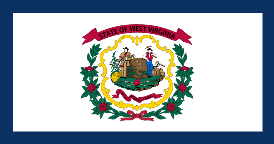
| 41 |
West Virginia
|
24,038 | 62,258 | South |
| 42 |
Maryland
|
9,707 | 25,141 | South |
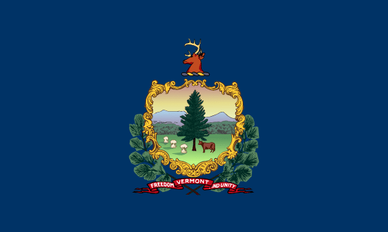
| 43 |
Vermont
|
9,217 | 23,872 | Northeast |
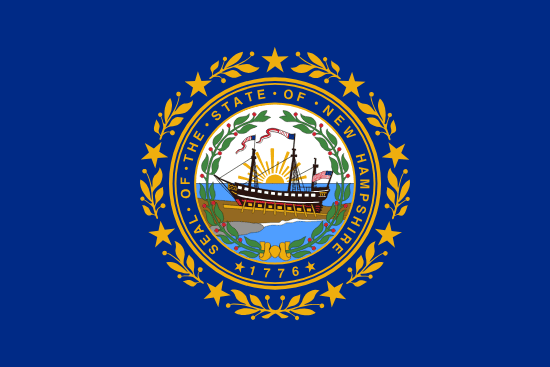
| 44 |
New Hampshire
|
8,953 | 23,188 | Northeast |
| 45 |
Massachusetts
|
7,800 | 20,202 | Northeast |
| 46 |
New Jersey
|
7,354 | 19,047 | Northeast |
| 47 |
Hawaii
|
6,423 | 16,635 | West |
| 48 |
Connecticut
|
4,842 | 12,542 | Northeast |
| 49 |
Delaware
|
1,949 | 5,048 | South |
| 50 |
Rhode Island
|
1,034 | 2,678 | Northeast |
No matching entries
Adjust the filter to show more entries.
Download as PDF
Print-ready table — States Ranked by Land Area
Largest and Smallest U.S. States by Land Area
Highest
Lowest

Top 10 Highest — Land area (sq mi)
Alaska
 Texas
Texas
 California
 Montana
 New Mexico
 Arizona
 Nevada
 Colorado
 Wyoming
 Oregon
Top 10 Lowest — Land area (sq mi)
Rhode Island
 Delaware
 Connecticut
 Hawaii
 New Jersey
 Massachusetts
 New Hampshire
 Vermont
 Maryland
 West Virginia
Largest States in the U.S.
The five largest U.S. states — Alaska, Texas, California, Montana, and New Mexico — account for more than half of all U.S. land area combined. Alaska alone covers 570,641 square miles, more than twice the size of Texas (261,914 sq mi). Texas is the largest state in the contiguous United States; it would take more than 425 Rhode Islands to fill Alaska. Size does not always mean more borders, though — Texas has only four neighboring states, as shown in the states with the most neighboring states ranking.
Alaska is so large that if it were a country, it would rank 17th in the world by land area — bigger than France, Spain, and Germany combined. Wyoming and Oregon, which close out the top 10, are each larger than any state east of the Mississippi River.
| Rank | State | Land area (sq mi) |
|---|---|---|
| 1 | Alaska | 570641 |
| 2 | Texas | 261914 |
| 3 | California | 155959 |
| 4 | Montana | 145552 |
| 5 | New Mexico | 121298 |
| 6 | Arizona | 113594 |
| 7 | Nevada | 109781 |
| 8 | Colorado | 103642 |
| 9 | Wyoming | 97093 |
| 10 | Oregon | 95988 |
Smallest States in the U.S.
The five smallest U.S. states — Rhode Island, Delaware, Connecticut, New Jersey, and New Hampshire — combined total only 24,132 square miles, less land than West Virginia (24,038 sq mi) occupies alone. Rhode Island, at 1,034 square miles, can be driven end-to-end in about an hour, yet it has a population density higher than all but two other states.
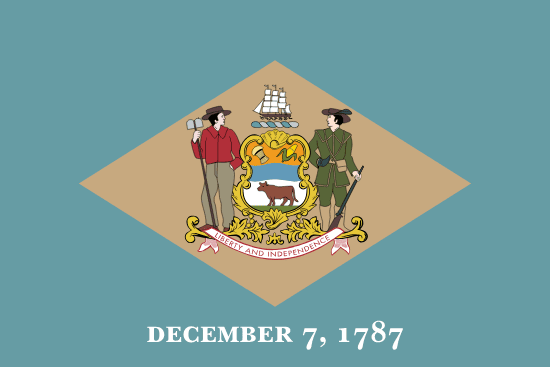
New Jersey is the most densely populated state in the country, fitting 9.3 million residents into 7,354 square miles. Delaware was the first state to ratify the U.S. Constitution in 1787 — a landmark that punches well above its 1,949 square miles. Four of the five smallest states rank among the top 15 for GDP per capita.
| Rank | State | Land area (sq mi) |
|---|---|---|
| 41 | West Virginia | 24038 |
| 42 | Maryland | 9707 |
| 43 | Vermont | 9217 |
| 44 | New Hampshire | 8953 |
| 45 | Massachusetts | 7800 |
| 46 | New Jersey | 7354 |
| 47 | Hawaii | 6423 |
| 48 | Connecticut | 4842 |
| 49 | Delaware | 1949 |
| 50 | Rhode Island | 1034 |
U.S. States by Size in Square Miles
All 50 states are ranked here by land area in square miles — the Census Bureau standard for comparing state sizes. Land area means dry ground only: rivers, lakes, reservoirs, and coastal waters are excluded. Square kilometers are shown alongside. To sort by total area or water area instead, use the column headers in the main table.
Land Area vs. Total Area
Land area counts only the solid ground within a state's boundaries. Total area adds all water bodies — lakes, rivers, reservoirs, and coastal waters within state lines. For most states the difference is small, but a few look very different depending on which number you use. Michigan ranks 22nd by land area (56,539 sq mi) but 11th by total area (96,714 sq mi) because the Great Lakes add more than 40,000 square miles of water. Florida, Louisiana, and Hawaii all shift several places when water is included. This page uses land area as the primary ranking metric, which is the Census Bureau standard for comparing state sizes.
| State | Land area rank | Total area rank | Why it changes |
|---|---|---|---|
| Alaska | 1 | 1 | 92,627 sq mi of water — rank unchanged because land area is dominant |
| Michigan | 22 | 11 | 40,175 sq mi of Great Lakes nearly doubles its total area |
| Florida | 26 | 22 | 12,133 sq mi of coastal waters and wetlands |
| Hawaii | 47 | 43 | 4,509 sq mi of ocean water lifts total area above Connecticut |
| Rhode Island | 50 | 50 | Still the smallest state by both measures |
Quick Answers
What is the largest state in the U.S.?
What are the biggest states in the U.S.?
What is the smallest state in the U.S.?
What are the smallest states in the U.S.?
What are the U.S. states by size in square miles?
Is state size measured by land area or total area?
What are U.S. states by area, ranked?
What are the U.S. states ranked by size?
What are the sizes of U.S. states in square miles?
Methodology
Land area uses U.S. Census Bureau measurements and excludes water. Total area and water area are available as alternate table metrics.
Sources
Build A Comparison
Compare Land Area Between States
Choose two states and see how their land area stacks up, with population and density context.
You Might Also Like

Serial Killers by State
Alaska has the highest serial killer rate at 0.867 per 100,000 residents. Hawaii is lowest, and California has the highest raw count at 128.

Flag of Arkansas
Arkansas had no state flag until 1913. Its white diamond marks the only diamond-producing state. A fourth star marks Confederate membership.

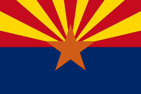
Flag of Arizona
Arizona's flag was sketched on an envelope in 1910 for a rifle team. Adopted in 1917, it became law without the governor's signature.

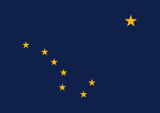
Flag of Alaska
Benny Benson designed Alaska's flag at 13. Eight gold stars on navy blue, the Big Dipper pointing to Polaris, adopted in 1927 and kept at statehood.

Alabama State Flag
Alabama's crimson cross on white was adopted in 1895, likely modeled after the Confederate Battle Flag. The state's first flag was destroyed by a storm one month after raising.

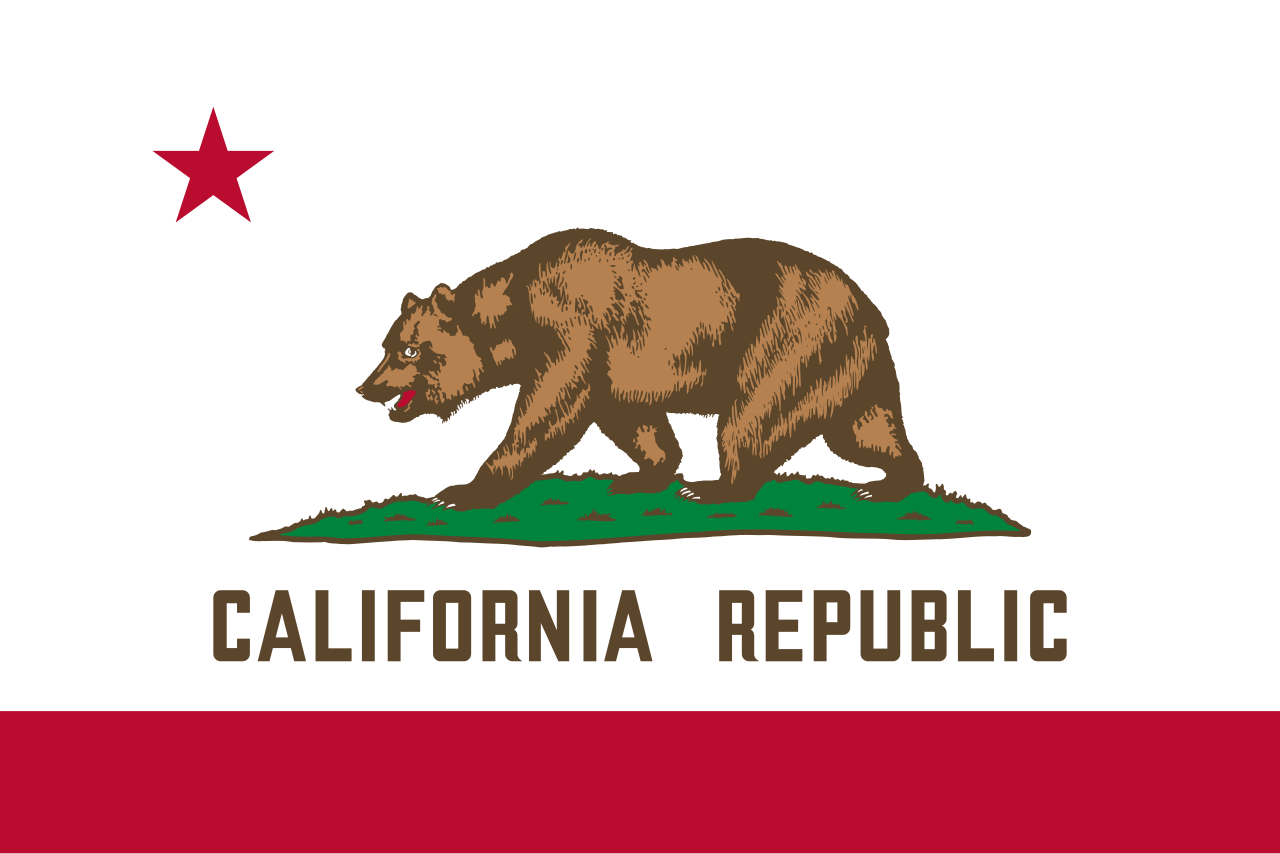
Flag of California
Brown grizzly on white, adopted in 1911, traces to settler William Todd's handmade flag raised at Sonoma on June 14, 1846.

Rainwater Harvesting Laws by State
Rainwater harvesting is legal in all 50 states. Colorado caps residential storage at 110 gallons, while Utah allows up to 2,500 gallons.

Weird Laws in Arkansas
Weird laws in Arkansas include a repealed statewide tattoo ban, a 145-year-old pronunciation law, and a Sunday car sales rule that is still enforced today.