States Ranked by Straight Line Borders

States Ranked by Straight Line Borders
Ranking - Geography
Quick Answer
States Ranked by Straight Line Borders
-
1
Colorado (99%) and Wyoming (98%) have the most geometric borders of any U.S. state; nearly every mile is a surveyed parallel or meridian. West Virginia (0%) and Hawaii (0%) have no straight borders at all.
-
2
Western states were carved from federal territory after 1785, when Congress adopted the rectangular Public Land Survey System. That grid produced straight borders by default. Eastern states predate the survey and follow colonial rivers, ridgelines, and coastlines instead.
-
3
The Mississippi River alone forms borders for 10 states. The Rio Grande defines all of Texas's southern and southwestern boundary, roughly 1,250 miles of river border with Mexico.
Map
States by Percentage of Straight-Line Borders Map

| Rank | State | % straight |
|---|---|---|
| 1 | Colorado | 99 |
| 2 | Wyoming | 98 |
| 3 | Kansas | 97 |
| 4 | New Mexico | 96 |
| 5 | Utah | 93 |
| 6 | Nevada | 88 |
| 7 | Arizona | 81 |
| 8 | Pennsylvania | 80 |
| 9 | South Dakota | 80 |
| 10 | Montana | 79 |
| 11 | North Dakota | 77 |
| 12 | Arkansas | 76 |
| 13 | Nebraska | 75 |
| 14 | Alabama | 73 |
| 15 | Mississippi | 72 |
| 16 | Connecticut | 68 |
| 17 | Massachusetts | 68 |
| 18 | Oklahoma | 65 |
| 19 | Indiana | 59 |
| 20 | Washington | 57 |
| 21 | North Carolina | 55 |
| 22 | Idaho | 53 |
| 23 | Minnesota | 52 |
| 24 | Georgia | 51 |
| 25 | Rhode Island | 50 |
| 26 | California | 46 |
| 27 | Oregon | 45 |
| 28 | Tennessee | 45 |
| 29 | South Carolina | 44 |
| 30 | New York | 42 |
| 31 | Iowa | 38 |
| 32 | Virginia | 38 |
| 33 | Vermont | 37 |
| 34 | New Hampshire | 35 |
| 35 | Ohio | 35 |
| 36 | Alaska | 30 |
| 37 | Maryland | 30 |
| 38 | New Jersey | 28 |
| 39 | Missouri | 27 |
| 40 | Wisconsin | 27 |
| 41 | Illinois | 25 |
| 42 | Louisiana | 25 |
| 43 | Florida | 24 |
| 44 | Maine | 24 |
| 45 | Delaware | 20 |
| 46 | Kentucky | 20 |
| 47 | Texas | 17 |
| 48 | Michigan | 12 |
| 49 | Hawaii | 0 |
| 50 | West Virginia | 0 |
The East-West divide is sharp: states west of the Mississippi average over 70% straight borders; states east average under 45%. Colorado, Wyoming, Kansas, New Mexico, and Utah all exceed 90%.
States Ranked by Straight Line Borders Table
50 entries


No matching entries
Adjust the filter to show more entries.
|
Rank
|
State
|
Straight lines (%)
|
Rivers & coast (%)
|
Ridgelines (%)
|
Character
|
|---|---|---|---|---|---|
| 1 |
Colorado
|
99 | 1 | 0 | Geometric |
| 2 |
Wyoming
|
98 | 2 | 0 | Geometric |
| 3 |
Kansas
|
97 | 3 | 0 | Geometric |
| 4 |
New Mexico
|
96 | 4 | 0 | Geometric |
| 5 |
Utah
|
93 | 7 | 0 | Geometric |
| 6 |
Nevada
|
88 | 12 | 0 | Geometric |
| 7 |
Arizona
|
81 | 19 | 0 | Geometric |
| 8 |
Pennsylvania
|
80 | 20 | 0 | Geometric |
| 9 |
South Dakota
|
80 | 20 | 0 | Geometric |
| 10 |
Montana
|
79 | 6 | 15 | Geometric |
| 11 |
North Dakota
|
77 | 23 | 0 | Mostly geometric |
| 12 |
Arkansas
|
76 | 24 | 0 | Mostly geometric |
| 13 |
Nebraska
|
75 | 25 | 0 | Mostly geometric |
| 14 |
Alabama
|
73 | 27 | 0 | Mostly geometric |
| 15 |
Mississippi
|
72 | 28 | 0 | Mostly geometric |
| 16 |
Connecticut
|
68 | 32 | 0 | Mostly geometric |
| 17 |
Massachusetts
|
68 | 32 | 0 | Mostly geometric |
| 18 |
Oklahoma
|
65 | 35 | 0 | Mostly geometric |
| 19 |
Indiana
|
59 | 41 | 0 | Mixed |
| 20 |
Washington
|
57 | 43 | 0 | Mixed |
| 21 |
North Carolina
|
55 | 16 | 29 | Mixed |
| 22 |
Idaho
|
53 | 27 | 20 | Mixed |
| 23 |
Minnesota
|
52 | 48 | 0 | Mixed |
| 24 |
Georgia
|
51 | 34 | 15 | Mixed |
| 25 |
Rhode Island
|
50 | 50 | 0 | Mixed |
| 26 |
California
|
46 | 54 | 0 | Mixed |
| 27 |
Oregon
|
45 | 55 | 0 | Mixed |
| 28 |
Tennessee
|
45 | 30 | 25 | Mixed |
| 29 |
South Carolina
|
44 | 56 | 0 | Mixed |
| 30 |
New York
|
42 | 58 | 0 | Mixed |
| 31 |
Iowa
|
38 | 62 | 0 | Mostly natural |
| 32 |
Virginia
|
38 | 37 | 25 | Mostly natural |
| 33 |
Vermont
|
37 | 63 | 0 | Mostly natural |
| 34 |
New Hampshire
|
35 | 60 | 5 | Mostly natural |
| 35 |
Ohio
|
35 | 65 | 0 | Mostly natural |
| 36 |
Alaska
|
30 | 58 | 12 | Mostly natural |
| 37 |
Maryland
|
30 | 70 | 0 | Mostly natural |
| 38 |
New Jersey
|
28 | 72 | 0 | Mostly natural |
| 39 |
Missouri
|
27 | 73 | 0 | Mostly natural |
| 40 |
Wisconsin
|
27 | 73 | 0 | Mostly natural |
| 41 |
Illinois
|
25 | 75 | 0 | Mostly natural |
| 42 |
Louisiana
|
25 | 75 | 0 | Mostly natural |
| 43 |
Florida
|
24 | 76 | 0 | Mostly natural |
| 44 |
Maine
|
24 | 76 | 0 | Mostly natural |
| 45 |
Delaware
|
20 | 80 | 0 | Mostly natural |
| 46 |
Kentucky
|
20 | 50 | 30 | Mostly natural |
| 47 |
Texas
|
17 | 83 | 0 | Natural |
| 48 |
Michigan
|
12 | 88 | 0 | Natural |
| 49 |
Hawaii
|
0 | 100 | 0 | Natural |
| 50 |
West Virginia
|
0 | 60 | 40 | Natural |
No matching entries
Adjust the filter to show more entries.
Download as PDF
Print-ready table — States Ranked by Straight Line Borders
Most Geometric and Most Natural State Borders
Highest
Lowest
Top 10 Highest — Straight lines (%)
Colorado
 Wyoming
 Kansas
 New Mexico
 Utah
Utah
 Nevada
 Arizona
 Pennsylvania
 South Dakota
 Montana
Top 10 Lowest — Straight lines (%)
West Virginia
 Hawaii
 Michigan
 Texas
Texas
 Kentucky
 Delaware
 Maine
Maine
 Florida
 Louisiana
 Illinois
States with the Most Straight Borders
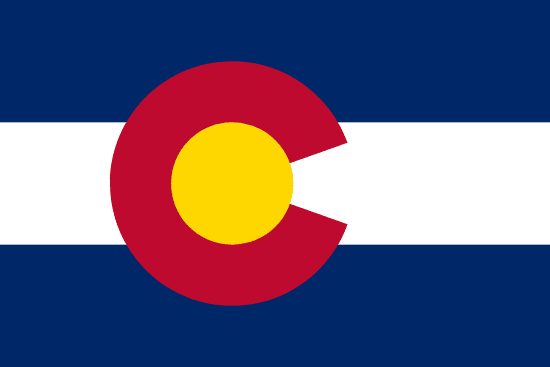
The five most geometric states — Colorado, Wyoming, Kansas, New Mexico, and Utah — all exceed 90% straight borders and were created entirely from federal territory using the Public Land Survey System grid. All five share at least two borders that are perfect parallels and two that are meridians. Colorado is the closest any U.S. state gets to a true rectangle: four surveyed lines, no rivers, no ridges.
Pennsylvania ranks 8th despite being a colonial-era eastern state. The Mason-Dixon line (south, with Maryland) was surveyed between 1763 and 1767 and is one of the most precisely drawn lines in American history. The western border with Ohio follows the 80°31' meridian, and the northern border with New York was surveyed in the 1780s. Only the Delaware River (east) and Lake Erie (northwest) break the geometry.
| Rank | State | Straight lines (%) | Rivers & coast (%) | Ridgelines (%) |
|---|---|---|---|---|
| 1 | Colorado | 99 | 1 | 0 |
| 2 | Wyoming | 98 | 2 | 0 |
| 3 | Kansas | 97 | 3 | 0 |
| 4 | New Mexico | 96 | 4 | 0 |
| 5 | Utah | 93 | 7 | 0 |
| 6 | Nevada | 88 | 12 | 0 |
| 7 | Arizona | 81 | 19 | 0 |
| 8 | Pennsylvania | 80 | 20 | 0 |
| 9 | South Dakota | 80 | 20 | 0 |
| 10 | Montana | 79 | 6 | 15 |
States with the Most Natural Borders
West Virginia has no straight borders at all: 0% of its perimeter is a surveyed line. The WV Encyclopedia documents the breakdown as 52% rivers, 31% ridge crests, and 17% lat/long lines — but those lat/long segments are not straight surveyed lines drawn by Congress; they follow watershed logic and local agreement. Every practical mile of its boundary follows the Ohio River (northwest), Big Sandy and Tug Fork rivers (east, with Kentucky), the Potomac River (northeast, with Maryland), or Allegheny ridge crests (southeast). Its jagged shape, often compared to a turkey foot, is entirely the product of physical geography.
Texas ranks 47th despite its reputation as a large, boxy state. The Rio Grande runs roughly 1,254 miles along the Mexican border. The Red River runs approximately 640 miles along the Oklahoma border. The Sabine River defines most of the Louisiana border. Only the borders with New Mexico and the Oklahoma panhandle are straight lines, totaling about 17% of the full perimeter. Michigan ranks 48th because the Great Lakes define nearly its entire boundary; the only straight segment is the short Indiana-Ohio land border in the south.
| Rank | State | Straight lines (%) | Rivers & coast (%) | Ridgelines (%) |
|---|---|---|---|---|
| 50 | West Virginia | 0 | 60 | 40 |
| 49 | Hawaii | 0 | 100 | 0 |
| 48 | Michigan | 12 | 88 | 0 |
| 47 | Texas | 17 | 83 | 0 |
| 46 | Kentucky | 20 | 50 | 30 |
| 45 | Delaware | 20 | 80 | 0 |
| 44 | Maine | 24 | 76 | 0 |
| 43 | Florida | 24 | 76 | 0 |
| 42 | Louisiana | 25 | 75 | 0 |
| 41 | Illinois | 25 | 75 | 0 |
The Surveyed West: Why Straight Lines Dominate

Congress passed the Land Ordinance of 1785, establishing the Public Land Survey System, a rectangular grid of north-south meridians and east-west parallels that would be used to partition all federal territory west of the Ohio River. Every state created from that territory afterward had its borders drawn on this grid, regardless of rivers, ridges, or any physical feature on the ground.
Colorado has four borders, all perfectly straight: the 37th and 41st parallels (south and north) and the 102nd and 109th meridians (east and west). The only break is a fraction of a percent where the Colorado River grazes the southwestern corner near the Four Corners monument. Wyoming's borders are equally rigid: four surveyed lines with no natural feature serving as a legal boundary anywhere along the full perimeter.
Kansas, New Mexico, and Utah are similar, all exceeding 93% straight. The practical effect was that western borders were drawn on paper before settlers arrived, with no existing rivers or colonial boundaries to negotiate. The result is visible from any satellite image: the West looks like a grid, the East does not.
Natural Borders: Rivers and the Eastern States

Missouri's borders are 73% river: the Mississippi along the east and southeast, the Missouri River along the north and west, and the Des Moines River at the northeast corner. Its only straight segment is the southern border with Arkansas along the 36°30' parallel, about 27% of the total perimeter. Iowa has a near-identical profile: straight only on the north and south parallels, with the Mississippi on the east and the Missouri plus Big Sioux on the west.
Texas combines all three natural types. The Red River defines its northern border with Oklahoma, running approximately 640 miles. The Sabine River defines most of its eastern border with Louisiana. The Rio Grande defines the entire southern and southwestern border with Mexico, roughly 1,254 miles of river border. Only the borders with New Mexico and the Oklahoma panhandle use straight lines. Texas is 83% natural despite its reputation as a large, boxy state — that mental image comes from its straight panhandle top, which is only a small fraction of the full perimeter.
Illinois ranks 41st at just 25% straight. The Mississippi River forms the entire western border, roughly 590 miles. The Ohio River defines the southern tip. The Wabash River forms part of the Indiana border. Only the Wisconsin border in the north and a portion of the Indiana border in the east are surveyed straight lines.
Mountain Border States: Appalachia and the Divide

Kentucky's eastern border with Virginia and West Virginia follows Appalachian ridge crests for about 30% of its perimeter. Tennessee's eastern border with North Carolina runs along the same chain for 25%. North Carolina's western border is defined by the Blue Ridge and Great Smoky Mountain divide. These ridge borders predate formal surveys; colonial-era governors agreed the watershed was the line because it was the most visible feature on the landscape.
Montana and Idaho share the Continental Divide along part of their mutual border. Idaho's eastern border follows the divide and the Snake River in alternating sections, producing a 20% mountain share. Montana's western border runs through the Bitterroot Range for about 15% of its perimeter. Alaska's border with Canada follows the 141st meridian on the east, then traces a coastal mountain arc in the southeast panhandle.
Surprising Cases: Pennsylvania, Connecticut, and Texas
Pennsylvania ranks 8th most geometric despite being a colonial-era eastern state. The Mason-Dixon line on the south, surveyed by Charles Mason and Jeremiah Dixon between 1763 and 1767, is one of the most precisely executed surveys in American history. The western border with Ohio follows the 80°31' meridian. The northern border with New York was surveyed in the 1780s. Only the Delaware River on the east (~140 miles) and Lake Erie on the northwest (~40 miles) introduce natural segments into an otherwise rectangular state.
Connecticut ranks 16th at 68% straight, higher than most people expect for a colonial New England state. Its three land borders with Massachusetts, Rhode Island, and New York were all established by colonial surveys in the 17th and 18th centuries and drawn as straight lines. Long Island Sound coastline on the south accounts for the remaining 32%. Massachusetts has an identical profile: three straight land borders and Atlantic coastline.
Texas ranks 47th, one of the most naturally bordered states in the country, despite the common image of a boxy state. Most of the outline that looks like a box — the panhandle top and the New Mexico line on the west — is only about 17% of the actual perimeter. The rest is three major rivers: the Red River, Sabine River, and Rio Grande, plus Gulf coastline.
Quick Answers
What U.S. state has the most straight borders
What state has the most natural borders
Why do western states have straight borders
Which states have the most river borders
Do any U.S. state borders follow mountain ridges
What is the squarest state in the U.S.
Methodology
Border segments were classified using Census TIGER/Line boundary files. Straight segments are surveyed parallels and meridians. Water segments include rivers, lakes, and ocean or Gulf coastline used as legal boundaries. Mountain segments follow topographic ridge divides. Percentages are approximate (plus or minus 5%) based on linear perimeter share and rounded to the nearest whole number.
Sources
You Might Also Like

Serial Killers by State
Alaska has the highest serial killer rate at 0.867 per 100,000 residents. Hawaii is lowest, and California has the highest raw count at 128.

Flag of Arkansas
Arkansas had no state flag until 1913. Its white diamond marks the only diamond-producing state. A fourth star marks Confederate membership.

Flag of Arizona
Arizona's flag was sketched on an envelope in 1910 for a rifle team. Adopted in 1917, it became law without the governor's signature.

Flag of Alaska
Benny Benson designed Alaska's flag at 13. Eight gold stars on navy blue, the Big Dipper pointing to Polaris, adopted in 1927 and kept at statehood.

Alabama State Flag
Alabama's crimson cross on white was adopted in 1895, likely modeled after the Confederate Battle Flag. The state's first flag was destroyed by a storm one month after raising.

Flag of California
Brown grizzly on white, adopted in 1911, traces to settler William Todd's handmade flag raised at Sonoma on June 14, 1846.

Rainwater Harvesting Laws by State
Rainwater harvesting is legal in all 50 states. Colorado caps residential storage at 110 gallons, while Utah allows up to 2,500 gallons.

Weird Laws in Arkansas
Weird laws in Arkansas include a repealed statewide tattoo ban, a 145-year-old pronunciation law, and a Sunday car sales rule that is still enforced today.